
English| USD
Suggested for you
More currencies
Choose a language
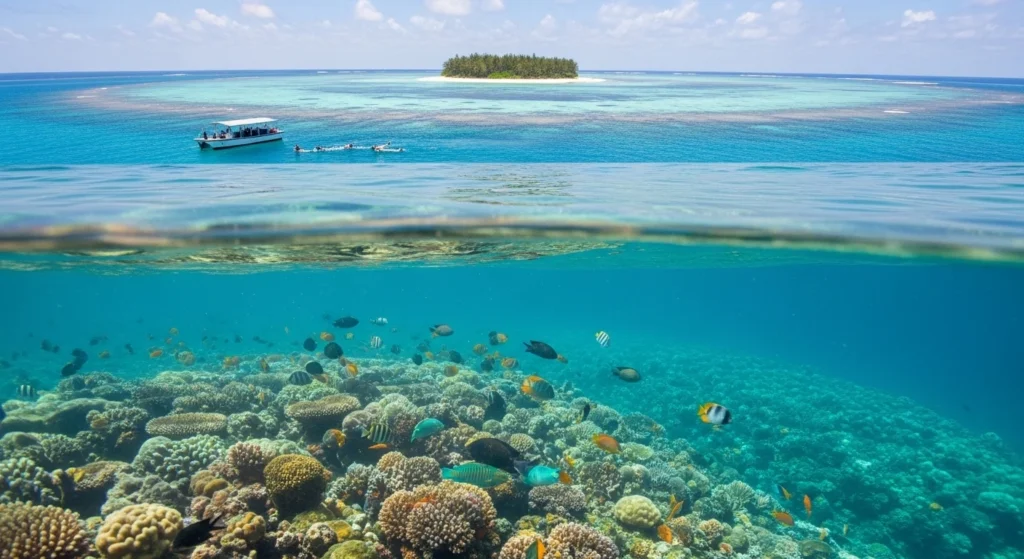
Mnemba Island sits inside a 2.5-kilometer marine conservation area marked by floating buoys and protected by Zanzibar's Marine Conservation Unit. The reef wraps the island in a horseshoe, with distinct zones defined by depth, current, and the coral formations that shelter green turtles, Napoleon wrasse, and seasonal schools of barracuda. Understanding the layout before you enter the water turns a drift into a targeted dive.
Quick answer
The zanzibar snorkeling map for Mnemba Island divides the conservation area into four primary zones: the northeast plateau (3-8 meters, calmest conditions), the eastern wall (8-18 meters, strongest currents), the southern gardens (5-12 meters, highest turtle density), and the western shallows (2-6 meters, beginner-friendly). Most operators anchor along the northern arc between 06:30 and 10:00 when visibility reaches 20-30 meters before trade winds churn the surface.
The Mnemba Island Marine Conservation Area spans roughly 450 hectares of protected reef, but only the outer perimeter—the zone accessible to day-trippers—appears on operator route maps. The island itself remains private, and the inner lagoon is off-limits. What visitors navigate is the outer reef ring, a crescent of coral plateaus, drop-offs, and sand channels that begins 200 meters offshore and extends to the conservation boundary markers. The northeast plateau is where most morning excursions begin. Depths here hold steady between three and eight meters, and the coral heads rise in clusters separated by white sand corridors. This is the zone boat captains favor when winds pick up after midday, and it is where beginners spend the majority of their water time. The eastern wall, by contrast, drops from eight meters to eighteen in a single slope, and the current runs south to north with enough force that operators time entries to slack tide. Advanced snorkelers drift this section deliberately, using the current to cover distance without effort, but it requires constant depth awareness and a guide who knows the exit points. The southern gardens, named for the density of soft coral and table formations, record the highest turtle sightings per hour—guides report an average of four to six green turtles on a single drift between the southern buoys. The substrate here is mixed: coral rubble interspersed with live Acropora patches and cleaning stations where wrasse congregate. Navigation depends on recognizing landmark formations, since GPS accuracy falters once swimmers are below the surface. Operators mark their preferred entry points with surface buoys, and the zanzibar snorkeling map most captains carry is a laminated chart annotated with depth soundings, seasonal current arrows, and the coordinates of three artificial moorings installed in 2019. The western shallows rarely appear in promotional material, but they serve a practical role. When the northeast trades blow at fifteen knots or higher, this lee-side zone remains flat enough for families and first-timers. Visibility drops to twelve meters on choppy days, and the coral diversity is lower, but the depth never exceeds six meters and the entry requires no giant stride. Operators rotate between zones based on wind direction, swell height, and group experience, so the route indicated on a booking confirmation is provisional. The conservation area enforces a ten-knot speed limit inside the buoy line, and boats must anchor rather than drift, which clusters activity into five or six well-worn sites rather than distributing it evenly across the reef. Understanding which zone matches your skill level and the day's conditions determines whether the outing feels controlled or chaotic.
“The reef wraps the island in a horseshoe, with distinct zones defined by depth, current, and the coral formations that shelter green turtles and Napoleon wrasse.”
The best arrival window for exploring the Mnemba Island reef is 06:30–10:00. Departing during these hours ensures calm seas and high water clarity before the onset of afternoon trade winds.
Dry, 25°C–28°C; stable visibility. Low rainfall reduces runoff for clearer water conditions.
Warm, 28°C–32°C; calm northern winds. Ideal for warmer water temperatures and consistent surface conditions.
Humid, 25°C–29°C; seasonal rains. Expect variable visibility due to occasional tropical showers.
—; calm seas. Early departures provide the most stable conditions before daily wind shifts.
Verdict: The best time to visit is during the dry season months of June to October, specifically arriving within the 06:30–10:00 morning window.
Pack the right gear and prepare for an early departure to Mnemba's protected waters.
Everything you need to know about zanzibar snorkeling map
You can find details on the Mnemba Island reef layout through local tour operators or by reviewing established marine navigation charts. A physical or digital zanzibar snorkeling map helps you identify the primary coral gardens and shallow shelves surrounding the atoll.
While signal can be inconsistent at sea, many navigators recommend downloading your zanzibar snorkeling map for offline use before departing the Matemwe coast. This ensures you can track your position near the reef even without cellular connectivity.
When using a zanzibar snorkeling map to explore the area, ensure you bring high-quality snorkeling gear, reef-safe sunscreen, and a waterproof bag. Carrying adequate water and a light snack is also advised for your boat journey.
Mnemba Island Snorkeling Guide
Read more Tickets & toursSnorkeling With Dolphins in Zanzibar
Read more GuideBest Snorkeling Spots in Zanzibar
Read more GuideSnorkeling from the Beach
Read more Tickets & toursZanzibar Snorkeling Tours
Read more GuideZanzibar Snorkeling Prices
Read more